 EKA SAMUDRA 1101
Current Status
Where is the vessel?
EKA SAMUDRA 1101 is currently in Near KIJANG, based on AIS data received about 14h ago.
Latest AIS update:
Current position: 0.89740° N, 104.61984° E (Near KIJANG)
Average speed (last 7 days): Loading…
Average speed (last 30 days): Loading…
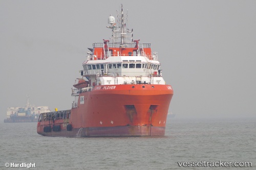
Vessel profile: EKA SAMUDRA 1101 is a Anchor Handling Vessel with dimensions m x m.
This page combines live AIS, route history, probable destination signals, nearby traffic, and port activity for practical vessel monitoring.
The current position of vessel EKA SAMUDRA 1101 is 0.89740 lat / 104.61984 lng. Updated: 2026-05-22 10:27:28 UTCNearest reference points:
- Near Lobam
- 19 nm SW of TANJUNG PINANG
- Near KABIL
Currently sailing under the flag of Indonesia ![]()
Details:
Live Vessel EKA SAMUDRA 1101 Analytics (details, animations, etc.)
Recent AIS points (UTC):
2026-05-22 07:41:27 UTC · 0.89741, 104.61987 · SOG 0 kn · COG 199°2026-05-22 08:27:47 UTC · 0.89744, 104.61985 · SOG 0 kn · COG 198°
2026-05-22 10:12:58 UTC · 0.89739, 104.61984 · SOG 0 kn · COG 198°
2026-05-22 10:27:28 UTC · 0.89740, 104.61984 · SOG 0 kn · COG 198°