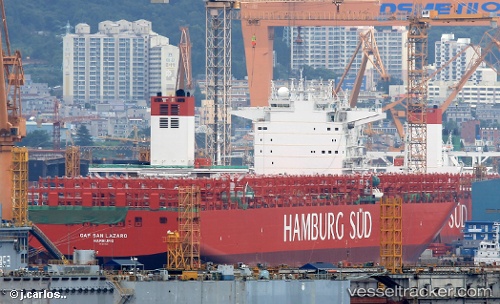
 Cap San Lazaro
Current Status
Where is the vessel?
Cap San Lazaro is currently in 307 nm E of Richards Bay, based on AIS data received about 15h ago.
Latest AIS update:
Current position: 30.48500° S, 37.71667° E (307 nm E of Richards Bay)
Average speed (last 7 days): Loading…
Average speed (last 30 days): Loading…
Vessel profile: Cap San Lazaro is a Container Ship with dimensions 332m x 48m.
This page combines live AIS, route history, probable destination signals, nearby traffic, and port activity for practical vessel monitoring.
The current position of vessel Cap San Lazaro is -30.48500 lat / 37.71667 lng. Updated: 2026-05-19 10:07:01 UTCNearest reference points:
- Open sea, approx. 400 nm off the nearest listed port
- Open sea, approx. 401 nm off the nearest listed port
- Open sea, approx. 402 nm off the nearest listed port
Currently sailing under the flag of Marshall Is ![]()
Details:
Live Vessel Cap San Lazaro Analytics (details, animations, etc.)
Recent AIS points (UTC):
2026-05-19 07:03:34 UTC · -30.18667, 38.62333 · SOG 16 kn · COG -1°2026-05-19 08:21:58 UTC · -30.31185, 38.23797 · SOG 16.7 kn · COG 249°
2026-05-19 10:04:36 UTC · -30.48057, 37.72747 · SOG 16.4 kn · COG 249°
2026-05-19 10:07:01 UTC · -30.48500, 37.71667 · SOG 16 kn · COG -1°