 vesseltracker.com
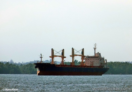
 STELIOS T
Current Status
Where is the vessel?
STELIOS T is currently in Open sea (no nearby ports in database), based on AIS data received about 14h ago.
Latest AIS update:
Current position: 6.50300° N, 25.45277° W (Open sea (no nearby ports in database))
Average speed (last 7 days): Loading…
Average speed (last 30 days): Loading…
Vessel profile: STELIOS T is a Bulk Carrier with dimensions m x m.
This page combines live AIS, route history, probable destination signals, nearby traffic, and port activity for practical vessel monitoring.
The current position of vessel STELIOS T is 6.50300 lat / -25.45277 lng. Updated: 2026-05-18 04:56:54 UTCNearest reference points:
- Open sea (no nearby ports in database)
Currently sailing under the flag of Marshall Islands ![]()
Details:
Live Vessel STELIOS T Analytics (details, animations, etc.)
Recent AIS points (UTC):
2026-05-18 01:11:34 UTC · 7.24147, -25.09711 · SOG 13.1 kn · COG 205°2026-05-18 02:00:43 UTC · 7.08192, -25.17656 · SOG 13 kn · COG 202°
2026-05-18 03:50:04 UTC · 6.72099, -25.34465 · SOG 12.9 kn · COG 204°
2026-05-18 04:56:54 UTC · 6.50300, -25.45277 · SOG 13.2 kn · COG 204°