 BAM DESPINA
Current Status
Where is the vessel?
BAM DESPINA is currently in 126 nm E of Ilha do Sal, based on AIS data received about 14h ago.
Latest AIS update:
Current position: 16.32685° N, 20.78079° W (126 nm E of Ilha do Sal)
Average speed (last 7 days): Loading…
Average speed (last 30 days): Loading…
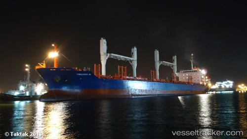
Vessel profile: BAM DESPINA is a Bulk Carrier with dimensions m x m.
This page combines live AIS, route history, probable destination signals, nearby traffic, and port activity for practical vessel monitoring.
The current position of vessel BAM DESPINA is 16.32685 lat / -20.78079 lng. Updated: 2026-05-20 19:32:19 UTCNearest reference points:
- Near Ilha do Sal
Currently sailing under the flag of Marshall Islands ![]()
Details:
Live Vessel BAM DESPINA Analytics (details, animations, etc.)
Recent AIS points (UTC):
2026-05-20 15:59:48 UTC · 15.80180, -21.05252 · SOG 9.6 kn · COG 27°2026-05-20 17:12:09 UTC · 15.97998, -20.96161 · SOG 10 kn · COG 26°
2026-05-20 17:51:59 UTC · 16.07880, -20.90902 · SOG 10 kn · COG 26°
2026-05-20 19:32:19 UTC · 16.32685, -20.78079 · SOG 10 kn · COG 23°