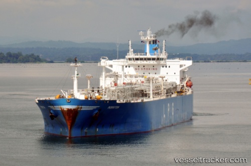
 BADRINATH
Current Status
Where is the vessel?
BADRINATH is currently in 330 nm SW of Rangali, based on AIS data received about 15h ago.
Latest AIS update:
Current position: 1.26333° N, 67.71500° E (330 nm SW of Rangali)
Average speed (last 7 days): Loading…
Average speed (last 30 days): Loading…
Vessel profile: BADRINATH is a Tanker with dimensions m x m.
This page combines live AIS, route history, probable destination signals, nearby traffic, and port activity for practical vessel monitoring.
The current position of vessel BADRINATH is 1.26333 lat / 67.71500 lng. Updated: 2026-05-23 07:34:26 UTCNearest reference points:
- Open sea, approx. 404 nm off the nearest listed port
- Open sea, approx. 405 nm off the nearest listed port
- Open sea, approx. 408 nm off the nearest listed port
Currently sailing under the flag of Marshall Islands ![]()
Details:
Live Vessel BADRINATH Analytics (details, animations, etc.)
Recent AIS points (UTC):
2026-05-23 03:55:24 UTC · 0.53667, 67.10833 · SOG 15 kn · COG -1°2026-05-23 06:04:25 UTC · 0.96500, 67.46167 · SOG 15 kn · COG -1°
2026-05-23 07:22:26 UTC · 1.22500, 67.68167 · SOG 15 kn · COG -1°
2026-05-23 07:34:26 UTC · 1.26333, 67.71500 · SOG 15 kn · COG -1°