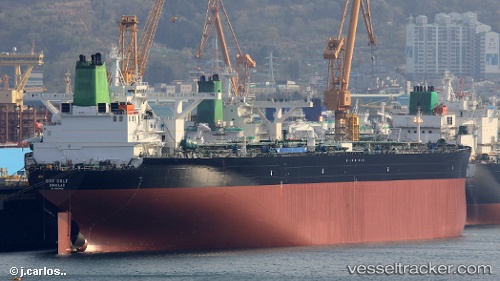
 DHT COLT
Current Status
Where is the vessel?
DHT COLT is currently in 36 nm E of Offshore Corpus Christi, based on AIS data received about 14h ago.
Latest AIS update:
Current position: 27.60667° N, 96.15167° W (36 nm E of Offshore Corpus Christi)
Average speed (last 7 days): Loading…
Average speed (last 30 days): Loading…
Vessel profile: DHT COLT is a Tanker with dimensions m x m.
This page combines live AIS, route history, probable destination signals, nearby traffic, and port activity for practical vessel monitoring.
The current position of vessel DHT COLT is 27.60667 lat / -96.15167 lng. Updated: 2026-05-22 21:56:59 UTCNearest reference points:
- 10 nm E of Port Aransas
- Near Matagorda Bay
- Near Port Aransas
Currently sailing under the flag of Marshall Islands ![]()
Details:
Live Vessel DHT COLT Analytics (details, animations, etc.)
Recent AIS points (UTC):
2026-05-22 18:08:58 UTC · 27.58333, -96.12500 · SOG 0 kn · COG -1°2026-05-22 19:32:58 UTC · 27.58833, -96.13333 · SOG 0 kn · COG -1°
2026-05-22 19:57:49 UTC · 27.59158, -96.13187 · SOG 0.9 kn · COG 50°
2026-05-22 21:56:59 UTC · 27.60667, -96.15167 · SOG 0 kn · COG -1°