 vesseltracker.com
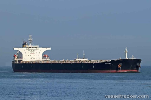
 CAPE LIUHENG
Current Status
Where is the vessel?
CAPE LIUHENG is currently in 272 nm W of Luderitz Bay, based on AIS data received about 14h ago.
Latest AIS update:
Current position: 26.06167° S, 10.14167° E (272 nm W of Luderitz Bay)
Average speed (last 7 days): Loading…
Average speed (last 30 days): Loading…
Vessel profile: CAPE LIUHENG is a Bulk Carrier with dimensions m x m.
This page combines live AIS, route history, probable destination signals, nearby traffic, and port activity for practical vessel monitoring.
The current position of vessel CAPE LIUHENG is -26.06167 lat / 10.14167 lng. Updated: 2026-05-18 04:47:04 UTCNearest reference points:
- Open sea, approx. 400 nm off the nearest listed port
- Open sea, approx. 416 nm off the nearest listed port
- Open sea, approx. 421 nm off the nearest listed port
Currently sailing under the flag of Marshall Islands ![]()
Details:
Live Vessel CAPE LIUHENG Analytics (details, animations, etc.)
Recent AIS points (UTC):
2026-05-18 01:43:00 UTC · -26.55500, 10.58500 · SOG 12 kn · COG -1°2026-05-18 02:01:05 UTC · -26.50667, 10.54167 · SOG 12 kn · COG -1°
2026-05-18 03:40:40 UTC · -26.24000, 10.30333 · SOG 12 kn · COG -1°
2026-05-18 04:47:04 UTC · -26.06167, 10.14167 · SOG 12 kn · COG -1°