 ATLANTIC SOUTH
Current Status
Where is the vessel?
ATLANTIC SOUTH is currently in 19 nm W of Nagaoka, based on AIS data received about 15h ago.
Latest AIS update:
Current position: 37.53833° N, 138.47667° E (19 nm W of Nagaoka)
Average speed (last 7 days): Loading…
Average speed (last 30 days): Loading…
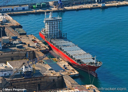
Vessel profile: ATLANTIC SOUTH is a Container Ship with dimensions m x m.
This page combines live AIS, route history, probable destination signals, nearby traffic, and port activity for practical vessel monitoring.
The current position of vessel ATLANTIC SOUTH is 37.53833 lat / 138.47667 lng. Updated: 2026-05-20 10:11:09 UTCNearest reference points:
- Near Toyama
- 63 nm NW of Sado Shima Apt
- Near Aomi
Currently sailing under the flag of Singapore ![]()
Details:
Live Vessel ATLANTIC SOUTH Analytics (details, animations, etc.)
Recent AIS points (UTC):
2026-05-20 07:49:28 UTC · 37.19385, 138.25752 · SOG 0 kn · COG 56°2026-05-20 07:49:28 UTC · 37.19385, 138.25752 · SOG 0 kn · COG 56°
2026-05-20 10:03:42 UTC · 37.51650, 138.46053 · SOG 12.6 kn · COG 34°
2026-05-20 10:11:09 UTC · 37.53833, 138.47667 · SOG 12 kn · COG -1°