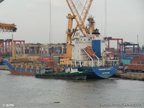
Tan Cang Foundation
Current StatusWhere is the vessel?
Tan Cang Foundation is currently in Near HAI PHONG, based on AIS data received about 14h ago.
Latest AIS update:
Current position: 20.85968° N, 106.72999° E (Near HAI PHONG)
Average speed (last 7 days): Loading…
Average speed (last 30 days): Loading…
Vessel profile: Tan Cang Foundation is a Container Ship with dimensions 18m x 113m.
This page combines live AIS, route history, probable destination signals, nearby traffic, and port activity for practical vessel monitoring.
The current position of vessel Tan Cang Foundation is 20.85968 lat / 106.72999 lng. Updated: 2026-05-21 19:28:00 UTCNearest reference points:
- Near HAI PHONG
- Near Chua Ve Terminal
- Near Haiphong
Details:
Live Vessel Tan Cang Foundation Analytics (details, animations, etc.)
Recent AIS points (UTC):
2026-05-21 16:07:04 UTC · 20.85967, 106.72995 · SOG 0.1 kn · COG 304°2026-05-21 17:46:02 UTC · 20.85965, 106.72992 · SOG 0.1 kn · COG 303°
2026-05-21 19:24:59 UTC · 20.85968, 106.73007 · SOG 0.2 kn · COG 304°
2026-05-21 19:28:00 UTC · 20.85968, 106.72999 · SOG 0 kn · COG 304°