 vesseltracker.com
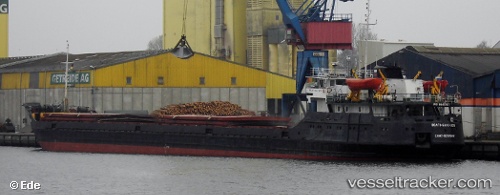
 VOLGO BALT 220
Current Status
Where is the vessel?
VOLGO BALT 220 is currently in Near TEKIRDAG, based on AIS data received about 14h ago.
Latest AIS update:
Current position: 40.96335° N, 27.50463° E (Near TEKIRDAG)
Average speed (last 7 days): Loading…
Average speed (last 30 days): Loading…
Vessel profile: VOLGO BALT 220 is a General Cargo with dimensions m x m.
This page combines live AIS, route history, probable destination signals, nearby traffic, and port activity for practical vessel monitoring.
The current position of vessel VOLGO BALT 220 is 40.96335 lat / 27.50463 lng. Updated: 2026-05-17 23:06:59 UTCNearest reference points:
- Near TEKIRDAG
- Near Saraylar
- Near Sarköy
Currently sailing under the flag of Comoros ![]()
Details:
Live Vessel VOLGO BALT 220 Analytics (details, animations, etc.)
Recent AIS points (UTC):
2026-05-17 19:04:40 UTC · 40.96331, 27.50464 · SOG 0 kn · COG 302°2026-05-17 19:25:21 UTC · 40.96331, 27.50465 · SOG 0 kn · COG 302°
2026-05-17 21:54:59 UTC · 40.96331, 27.50464 · SOG 0 kn · COG 302°
2026-05-17 23:06:59 UTC · 40.96335, 27.50463 · SOG 0 kn · COG 302°