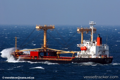
 ABRAHAM A
Current Status
Where is the vessel?
ABRAHAM A is currently in Near SUEZ PORT, based on AIS data received about 14h ago.
Latest AIS update:
Current position: 29.93960° N, 32.56004° E (Near SUEZ PORT)
Average speed (last 7 days): Loading…
Average speed (last 30 days): Loading…
Vessel profile: ABRAHAM A is a General Cargo with dimensions m x m.
This page combines live AIS, route history, probable destination signals, nearby traffic, and port activity for practical vessel monitoring.
The current position of vessel ABRAHAM A is 29.93960 lat / 32.56004 lng. Updated: 2026-05-18 18:22:17 UTCNearest reference points:
- Near SUEZ PORT
- Near As Suways (Suez)
- Near Bur Ibrahim
Currently sailing under the flag of Comoros ![]()
Details:
Live Vessel ABRAHAM A Analytics (details, animations, etc.)
Recent AIS points (UTC):
2026-05-18 13:28:21 UTC · 29.93966, 32.56006 · SOG 0 kn · COG -1°2026-05-18 15:58:16 UTC · 29.93966, 32.56006 · SOG 0 kn · COG 62°
2026-05-18 16:46:20 UTC · 29.93965, 32.56005 · SOG 0 kn · COG 62°
2026-05-18 18:22:17 UTC · 29.93960, 32.56004 · SOG 0 kn · COG 62°