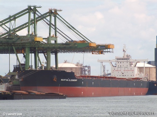
Martha Oldendorff
Current StatusWhere is the vessel?
Martha Oldendorff is currently in 60 nm E of Taytay Sandoval, based on AIS data received about 16h ago.
Latest AIS update:
Current position: 10.80166° N, 120.52833° E (60 nm E of Taytay Sandoval)
Average speed (last 7 days): Loading…
Average speed (last 30 days): Loading…
Vessel profile: Martha Oldendorff is a Bulk Carrier with dimensions 50m x 300m.
This page combines live AIS, route history, probable destination signals, nearby traffic, and port activity for practical vessel monitoring.
The current position of vessel Martha Oldendorff is 10.80166 lat / 120.52833 lng. Updated: 2026-05-22 19:58:43 UTCNearest reference points:
- 19 nm NE of CORON
- Near Iloilo
- 43 nm W of Malampaya
Details:
Live Vessel Martha Oldendorff Analytics (details, animations, etc.)
Recent AIS points (UTC):
2026-05-22 16:34:44 UTC · 11.62667, 120.61500 · SOG 14 kn · COG -1°2026-05-22 17:55:43 UTC · 11.30333, 120.52500 · SOG 14 kn · COG -1°
2026-05-22 19:43:43 UTC · 10.86333, 120.52333 · SOG 14 kn · COG -1°
2026-05-22 19:58:43 UTC · 10.80166, 120.52833 · SOG 14 kn · COG -1°