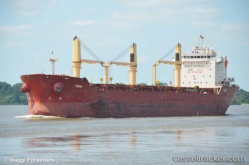
 Sunda
Sunda
Current Status
Where is the vessel?
Sunda is currently in Near PORT COLBORNE, based on AIS data received about 14h ago.
Latest AIS update:
Current position: 42.83505° N, 79.27112° W (Near PORT COLBORNE)
Average speed (last 7 days): Loading…
Average speed (last 30 days): Loading…
Vessel profile: Sunda is a Bulk Carrier with dimensions 186m x 24m.
This page combines live AIS, route history, probable destination signals, nearby traffic, and port activity for practical vessel monitoring.
The current position of vessel Sunda is 42.83505 lat / -79.27112 lng. Updated: 2026-05-20 01:34:05 UTCNearest reference points:
- Near Hannon
- Near OAKVILLE
- Near TORONTO
Currently sailing under the flag of Liberia ![]()
Sunda built in 2010 year
Deadweight:
29800 tDetails:
Live Vessel Sunda Analytics (details, animations, etc.)
Recent AIS points (UTC):
2026-05-19 22:06:45 UTC · 42.41671, -80.08318 · SOG 13.3 kn · COG 59°2026-05-19 23:03:45 UTC · 42.53536, -79.84489 · SOG 13.4 kn · COG 55°
2026-05-20 00:20:23 UTC · 42.69345, -79.52362 · SOG 13.4 kn · COG 58°
2026-05-20 01:34:05 UTC · 42.83505, -79.27112 · SOG 6.1 kn · COG 25°