 vesseltracker.com
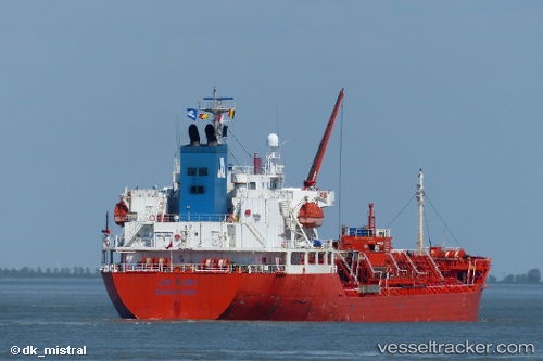
Stolt Kiri
Current StatusWhere is the vessel?
Stolt Kiri is currently in Near Port Bolivar, based on AIS data received about 15h ago.
Latest AIS update:
Current position: 29.37372° N, 94.80430° W (Near Port Bolivar)
Average speed (last 7 days): Loading…
Average speed (last 30 days): Loading…
Vessel profile: Stolt Kiri is a Chemical Oil Products Tanker with dimensions 24m x 145m.
This page combines live AIS, route history, probable destination signals, nearby traffic, and port activity for practical vessel monitoring.
The current position of vessel Stolt Kiri is 29.37372 lat / -94.80430 lng. Updated: 2026-05-18 01:46:48 UTCNearest reference points:
- Near Port Bolivar
- Near Texas City
- 12 nm SE of Port Bolivar
Details:
Live Vessel Stolt Kiri Analytics (details, animations, etc.)
Recent AIS points (UTC):
2026-05-17 21:58:58 UTC · 29.29151, -94.56493 · SOG 0.1 kn · COG 95°2026-05-17 22:38:04 UTC · 29.29166, -94.56495 · SOG 0.5 kn · COG 94°
2026-05-18 00:21:51 UTC · 29.28946, -94.56327 · SOG 3.2 kn · COG 221°
2026-05-18 01:46:48 UTC · 29.37372, -94.80430 · SOG 10.2 kn · COG 331°