 Aqualibra
Current Status
Where is the vessel?
Aqualibra is currently in 171 nm NW of Nemba, based on AIS data received about 14h ago.
Latest AIS update:
Current position: 8.39909° S, 164.08322° E (171 nm NW of Nemba)
Average speed (last 7 days): Loading…
Average speed (last 30 days): Loading…
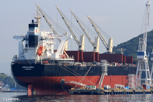
Vessel profile: Aqualibra is a Bulk Carrier with dimensions 196m x 32m.
This page combines live AIS, route history, probable destination signals, nearby traffic, and port activity for practical vessel monitoring.
The current position of vessel Aqualibra is -8.39909 lat / 164.08322 lng. Updated: 2026-05-21 17:12:59 UTCCurrently sailing under the flag of Liberia ![]()
Details:
Live Vessel Aqualibra Analytics (details, animations, etc.)
Recent AIS points (UTC):
2026-05-21 13:23:25 UTC · -9.03375, 163.73016 · SOG 11.4 kn · COG 32°2026-05-21 14:18:19 UTC · -8.88353, 163.81442 · SOG 11.2 kn · COG 31°
2026-05-21 15:23:47 UTC · -8.69918, 163.91432 · SOG 11.3 kn · COG 32°
2026-05-21 17:12:59 UTC · -8.39909, 164.08322 · SOG 11.3 kn · COG 30°