 CL MONA
Current Status
Where is the vessel?
CL MONA is currently in Near Xinsha, based on AIS data received about 15h ago.
Latest AIS update:
Current position: 23.00239° N, 113.53334° E (Near Xinsha)
Average speed (last 7 days): Loading…
Average speed (last 30 days): Loading…
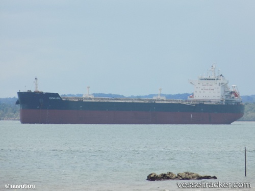
Vessel profile: CL MONA is a Bulk Carrier with dimensions 229m x 33m.
This page combines live AIS, route history, probable destination signals, nearby traffic, and port activity for practical vessel monitoring.
The current position of vessel CL MONA is 23.00239 lat / 113.53334 lng. Updated: 2026-05-19 05:33:33 UTCNearest reference points:
- Near Shilou
- Near Xinsha
- Near MCID - Private Terminal
Currently sailing under the flag of Liberia ![]()
CL MONA built in 2013 year
Deadweight:
81504 tDetails:
Live Vessel CL MONA Analytics (details, animations, etc.)
Recent AIS points (UTC):
2026-05-19 02:09:36 UTC · 23.00237, 113.53334 · SOG 0.1 kn · COG 339°2026-05-19 03:36:33 UTC · 23.00239, 113.53333 · SOG 0 kn · COG 339°
2026-05-19 04:06:34 UTC · 23.00239, 113.53330 · SOG 0 kn · COG 339°
2026-05-19 05:33:33 UTC · 23.00239, 113.53334 · SOG 0 kn · COG 339°