 PAROS
PAROS
Current Status
Where is the vessel?
PAROS is currently in 270 nm E of Richards Bay, based on AIS data received about 14h ago.
Latest AIS update:
Current position: 30.48183° S, 36.95342° E (270 nm E of Richards Bay)
Average speed (last 7 days): Loading…
Average speed (last 30 days): Loading…
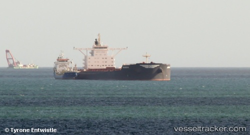
Vessel profile: PAROS is a Bulk Carrier with dimensions m x m.
This page combines live AIS, route history, probable destination signals, nearby traffic, and port activity for practical vessel monitoring.
The current position of vessel PAROS is -30.48183 lat / 36.95342 lng. Updated: 2026-05-22 04:11:01 UTCNearest reference points:
- 163 nm SE of Richards Bay
- 358 nm E of Richards Bay
- Open sea, approx. 400 nm off the nearest listed port
Currently sailing under the flag of Liberia ![]()
Details:
Live Vessel PAROS Analytics (details, animations, etc.)
Recent AIS points (UTC):
2026-05-22 01:09:28 UTC · -30.65525, 36.39033 · SOG 9.8 kn · COG 66°2026-05-22 02:04:47 UTC · -30.60112, 36.55850 · SOG 10.2 kn · COG 68°
2026-05-22 03:29:08 UTC · -30.52125, 36.82130 · SOG 10.4 kn · COG 70°
2026-05-22 04:11:01 UTC · -30.48183, 36.95342 · SOG 10.3 kn · COG 71°