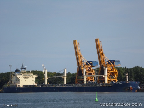
 BULK SACHUEST
Current Status
Where is the vessel?
BULK SACHUEST is currently in Near Charleston Heights, based on AIS data received about 14h ago.
Latest AIS update:
Current position: 32.85793° N, 79.95598° W (Near Charleston Heights)
Average speed (last 7 days): Loading…
Average speed (last 30 days): Loading…
Vessel profile: BULK SACHUEST is a Bulk Carrier with dimensions m x m.
This page combines live AIS, route history, probable destination signals, nearby traffic, and port activity for practical vessel monitoring.
The current position of vessel BULK SACHUEST is 32.85793 lat / -79.95598 lng. Updated: 2026-05-21 13:57:38 UTCNearest reference points:
- Near Charleston
- 33 nm S of Kiawah Island
- Near Saint Andrews
Currently sailing under the flag of Liberia ![]()
Details:
Live Vessel BULK SACHUEST Analytics (details, animations, etc.)
Recent AIS points (UTC):
2026-05-21 10:43:02 UTC · 32.85667, -79.95500 · SOG 0 kn · COG -1°2026-05-21 11:58:02 UTC · 32.85667, -79.95500 · SOG 0 kn · COG -1°
2026-05-21 13:39:35 UTC · 32.85797, -79.95599 · SOG 0 kn · COG -1°
2026-05-21 13:57:38 UTC · 32.85793, -79.95598 · SOG 0 kn · COG -1°