 NGM PANTHER
Current Status
Where is the vessel?
NGM PANTHER is currently in 209 nm S of Frégate, based on AIS data received about 14h ago.
Latest AIS update:
Current position: 7.85500° S, 57.13500° E (209 nm S of Frégate)
Average speed (last 7 days): Loading…
Average speed (last 30 days): Loading…
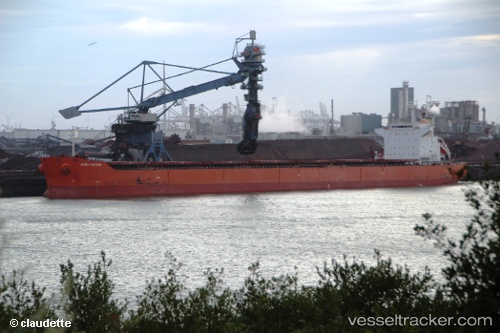
Vessel profile: NGM PANTHER is a Bulk Carrier with dimensions m x m.
This page combines live AIS, route history, probable destination signals, nearby traffic, and port activity for practical vessel monitoring.
The current position of vessel NGM PANTHER is -7.85500 lat / 57.13500 lng. Updated: 2026-05-19 15:43:26 UTCNearest reference points:
- 217 nm SE of Ile Desroches
- Open sea, approx. 403 nm off the nearest listed port
- Open sea, approx. 409 nm off the nearest listed port
Currently sailing under the flag of Liberia ![]()
Details:
Live Vessel NGM PANTHER Analytics (details, animations, etc.)
Recent AIS points (UTC):
2026-05-19 12:03:18 UTC · -8.13737, 56.52860 · SOG 10.2 kn · COG 58°2026-05-19 13:46:25 UTC · -7.99667, 56.80333 · SOG 10 kn · COG -1°
2026-05-19 14:10:28 UTC · -7.96667, 56.86833 · SOG 10 kn · COG -1°
2026-05-19 15:43:26 UTC · -7.85500, 57.13500 · SOG 11 kn · COG -1°