 OAKTREE
Current Status
Where is the vessel?
OAKTREE is currently in 399 nm NW of Apra, based on AIS data received about 14h ago.
Latest AIS update:
Current position: 17.03167° N, 138.80833° E (399 nm NW of Apra)
Average speed (last 7 days): Loading…
Average speed (last 30 days): Loading…
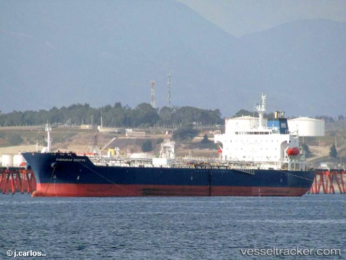
Vessel profile: OAKTREE is a Oil/Chemical Tanker with dimensions m x m.
This page combines live AIS, route history, probable destination signals, nearby traffic, and port activity for practical vessel monitoring.
The current position of vessel OAKTREE is 17.03167 lat / 138.80833 lng. Updated: 2026-05-20 07:49:10 UTCNearest reference points:
- Open sea, approx. 402 nm off the nearest listed port
- Open sea, approx. 404 nm off the nearest listed port
- Open sea, approx. 406 nm off the nearest listed port
Currently sailing under the flag of Liberia ![]()
Details:
Live Vessel OAKTREE Analytics (details, animations, etc.)
Recent AIS points (UTC):
2026-05-20 04:01:08 UTC · 16.80333, 139.64500 · SOG 13 kn · COG -1°2026-05-20 05:30:19 UTC · 16.89393, 139.32420 · SOG 12.6 kn · COG 282°
2026-05-20 07:46:05 UTC · 17.02833, 138.81833 · SOG 13 kn · COG -1°
2026-05-20 07:49:10 UTC · 17.03167, 138.80833 · SOG 13 kn · COG -1°