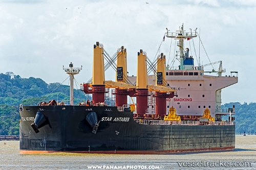
 STAR ANTARES
Current Status
Where is the vessel?
STAR ANTARES is currently in 47 nm SE of Cape Agulhas, based on AIS data received about 15h ago.
Latest AIS update:
Current position: 35.16383° S, 20.85596° E (47 nm SE of Cape Agulhas)
Average speed (last 7 days): Loading…
Average speed (last 30 days): Loading…
Vessel profile: STAR ANTARES is a Cargo with dimensions m x m.
This page combines live AIS, route history, probable destination signals, nearby traffic, and port activity for practical vessel monitoring.
The current position of vessel STAR ANTARES is -35.16383 lat / 20.85596 lng. Updated: 2026-05-20 13:50:06 UTCNearest reference points:
- 37 nm S of Mosselbaai
- 16 nm S of Mosselbaai
- Near Mosselbaai
Currently sailing under the flag of Liberia ![]()
Details:
Live Vessel STAR ANTARES Analytics (details, animations, etc.)
Recent AIS points (UTC):
2026-05-20 10:17:24 UTC · -35.11271, 20.17413 · SOG 9.5 kn · COG 95°2026-05-20 11:36:59 UTC · -35.14135, 20.42578 · SOG 9.6 kn · COG 99°
2026-05-20 13:02:36 UTC · -35.17137, 20.70427 · SOG 9.9 kn · COG 91°
2026-05-20 13:50:06 UTC · -35.16383, 20.85596 · SOG 9.6 kn · COG 84°