 vesseltracker.com
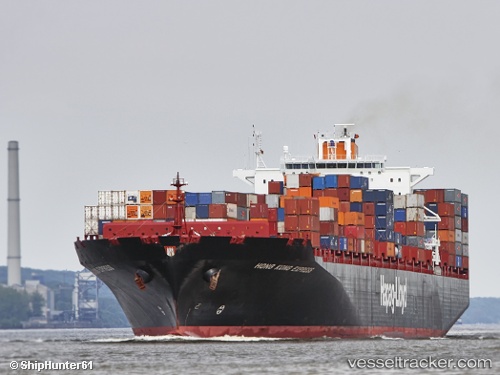
 NINGBO EXPRESS
Current Status
Where is the vessel?
NINGBO EXPRESS is currently in 57 nm SW of Chebogue Point, based on AIS data received about 14h ago.
Latest AIS update:
Current position: 43.08833° N, 67.06500° W (57 nm SW of Chebogue Point)
Average speed (last 7 days): Loading…
Average speed (last 30 days): Loading…
Vessel profile: NINGBO EXPRESS is a Container Ship with dimensions m x m.
This page combines live AIS, route history, probable destination signals, nearby traffic, and port activity for practical vessel monitoring.
The current position of vessel NINGBO EXPRESS is 43.08833 lat / -67.06500 lng. Updated: 2026-05-18 12:11:50 UTCNearest reference points:
- Near Wedgeport
- Near Lower Woods Harbour
- 16 nm W of Tiverton
Currently sailing under the flag of Liberia ![]()
Details:
Live Vessel NINGBO EXPRESS Analytics (details, animations, etc.)
Recent AIS points (UTC):
2026-05-18 08:04:57 UTC · 44.19387, -66.98485 · SOG 17.8 kn · COG 201°2026-05-18 09:32:19 UTC · 43.80167, -67.15833 · SOG 17 kn · COG -1°
2026-05-18 10:26:34 UTC · 43.56167, -67.09333 · SOG 17 kn · COG -1°
2026-05-18 12:11:50 UTC · 43.08833, -67.06500 · SOG 16 kn · COG -1°