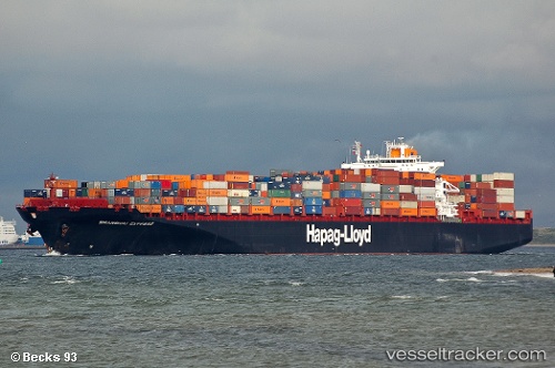
 YANTIAN EXPRESS
Current Status
Where is the vessel?
YANTIAN EXPRESS is currently in Near Savannah, based on AIS data received about 14h ago.
Latest AIS update:
Current position: 32.13282° N, 81.13895° W (Near Savannah)
Average speed (last 7 days): Loading…
Average speed (last 30 days): Loading…
Vessel profile: YANTIAN EXPRESS is a Container Ship with dimensions m x m.
This page combines live AIS, route history, probable destination signals, nearby traffic, and port activity for practical vessel monitoring.
The current position of vessel YANTIAN EXPRESS is 32.13282 lat / -81.13895 lng. Updated: 2026-05-18 20:07:06 UTCNearest reference points:
- Near Saint Andrews
- Near Brunswick
- 33 nm S of Kiawah Island
Currently sailing under the flag of Liberia ![]()
Details:
Live Vessel YANTIAN EXPRESS Analytics (details, animations, etc.)
Recent AIS points (UTC):
2026-05-18 16:47:02 UTC · 31.94223, -80.67565 · SOG 10.5 kn · COG 300°2026-05-18 17:30:46 UTC · 32.03638, -80.83311 · SOG 11.9 kn · COG 290°
2026-05-18 19:38:45 UTC · 32.10473, -81.11748 · SOG 6.2 kn · COG 316°
2026-05-18 20:07:06 UTC · 32.13282, -81.13895 · SOG 1.5 kn · COG 349°