 YENISEY
Current Status
Where is the vessel?
YENISEY is currently in 132 nm NE of Dokdo, based on AIS data received about 14h ago.
Latest AIS update:
Current position: 38.48000° N, 134.13834° E (132 nm NE of Dokdo)
Average speed (last 7 days): Loading…
Average speed (last 30 days): Loading…
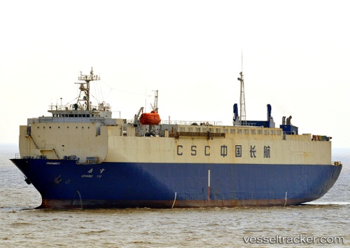
Vessel profile: YENISEY is a Vehicles Carrier with dimensions 110m x 21m.
This page combines live AIS, route history, probable destination signals, nearby traffic, and port activity for practical vessel monitoring.
The current position of vessel YENISEY is 38.48000 lat / 134.13834 lng. Updated: 2026-05-23 00:00:21 UTCNearest reference points:
- 82 nm NE of Dokdo
- 80 nm NE of Dokdo
- 94 nm N of Dokdo
Currently sailing under the flag of Sierra Leone ![]()
YENISEY built in 1990 year
Deadweight:
5228 tDetails:
Live Vessel YENISEY Analytics (details, animations, etc.)
Recent AIS points (UTC):
2026-05-22 19:57:19 UTC · 37.72500, 134.47667 · SOG 11 kn · COG -1°2026-05-22 22:12:21 UTC · 38.13667, 134.30333 · SOG 11 kn · COG -1°
2026-05-22 22:36:21 UTC · 38.21167, 134.27333 · SOG 11 kn · COG -1°
2026-05-23 00:00:21 UTC · 38.48000, 134.13834 · SOG 12 kn · COG -1°