 ALMABROUKA 11
Current Status
Where is the vessel?
ALMABROUKA 11 is currently in 40 nm NE of Dabo, based on AIS data received about 14h ago.
Latest AIS update:
Current position: 13.73833° N, 42.45833° E (40 nm NE of Dabo)
Average speed (last 7 days): Loading…
Average speed (last 30 days): Loading…
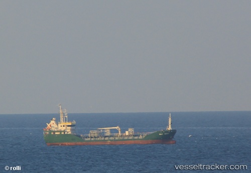
Vessel profile: ALMABROUKA 11 is a General Cargo with dimensions m x m.
This page combines live AIS, route history, probable destination signals, nearby traffic, and port activity for practical vessel monitoring.
The current position of vessel ALMABROUKA 11 is 13.73833 lat / 42.45833 lng. Updated: 2026-05-19 19:27:12 UTCNearest reference points:
- Near Djibouti
- 81 nm NW of As Salif
Currently sailing under the flag of Tanzania ![]()
Details:
Live Vessel ALMABROUKA 11 Analytics (details, animations, etc.)
Recent AIS points (UTC):
2026-05-19 15:48:16 UTC · 14.19833, 42.23833 · SOG 8 kn · COG -1°2026-05-19 17:57:11 UTC · 13.91833, 42.36833 · SOG 8 kn · COG -1°
2026-05-19 19:27:12 UTC · 13.73833, 42.45833 · SOG 7 kn · COG -1°
2026-05-19 19:27:12 UTC · 13.73833, 42.45833 · SOG 7 kn · COG -1°