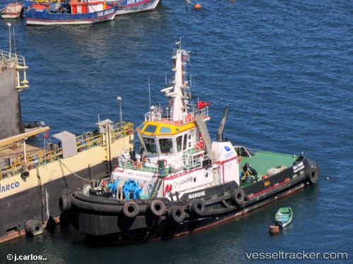
 Makohe
Current Status
Where is the vessel?
Makohe is currently in Near Puerto Natales, based on AIS data received about 15h ago.
Latest AIS update:
Current position: 51.69892° S, 72.53177° W (Near Puerto Natales)
Average speed (last 7 days): Loading…
Average speed (last 30 days): Loading…
Vessel profile: Makohe is a Tug with dimensions 32m x 12m.
This page combines live AIS, route history, probable destination signals, nearby traffic, and port activity for practical vessel monitoring.
The current position of vessel Makohe is -51.69892 lat / -72.53177 lng. Updated: 2026-05-23 04:20:25 UTCCurrently sailing under the flag of Chile ![]()
Makohe built in 2013 year
Deadweight:
284 tDetails:
Live Vessel Makohe Analytics (details, animations, etc.)
Recent AIS points (UTC):
2026-05-23 01:26:26 UTC · -51.69868, -72.53213 · SOG 0 kn · COG 113°2026-05-23 02:50:22 UTC · -51.69885, -72.53215 · SOG 0 kn · COG 41°
2026-05-23 03:26:27 UTC · -51.69895, -72.53193 · SOG 0 kn · COG 330°
2026-05-23 04:20:25 UTC · -51.69892, -72.53177 · SOG 0 kn · COG 312°