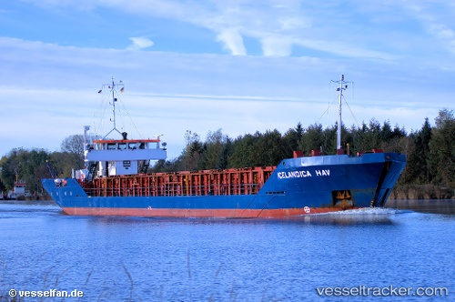
 Icelandicahav
Current Status
Where is the vessel?
Icelandicahav is currently in 15 nm NW of Ile D’Ouessant, based on AIS data received about 14h ago.
Latest AIS update:
Current position: 48.79738° N, 5.82788° W (15 nm NW of Ile D’Ouessant)
Average speed (last 7 days): Loading…
Average speed (last 30 days): Loading…
Vessel profile: Icelandicahav is a Multi Purpose Carrier with dimensions 82m x 11m.
This page combines live AIS, route history, probable destination signals, nearby traffic, and port activity for practical vessel monitoring.
The current position of vessel Icelandicahav is 48.79738 lat / -5.82788 lng. Updated: 2026-05-18 19:59:04 UTCNearest reference points:
- 16 nm NW of Ile D’Ouessant
- 18 nm NE of Ile D’Ouessant
- 35 nm SW of Ile D’Ouessant
Currently sailing under the flag of Bahamas ![]()
Icelandicahav built in 1982 year
Deadweight:
2325 tDetails:
Live Vessel Icelandicahav Analytics (details, animations, etc.)
Recent AIS points (UTC):
2026-05-18 16:21:55 UTC · 48.96489, -5.54183 · SOG 4.7 kn · COG 236°2026-05-18 17:58:33 UTC · 48.90347, -5.69463 · SOG 4.1 kn · COG 236°
2026-05-18 19:36:51 UTC · 48.82265, -5.80548 · SOG 4.9 kn · COG -1°
2026-05-18 19:59:04 UTC · 48.79738, -5.82788 · SOG 5 kn · COG 217°