 FORTITUDE
Current Status
Where is the vessel?
FORTITUDE is currently in Near ST THOMAS, based on AIS data received about 21h ago.
Latest AIS update:
Current position: 18.33538° N, 64.92267° W (Near ST THOMAS)
Average speed (last 7 days): Loading…
Average speed (last 30 days): Loading…
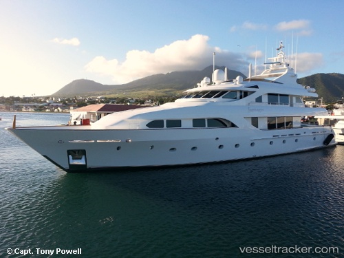
Vessel profile: FORTITUDE is a Yacht with dimensions m x m.
This page combines live AIS, route history, probable destination signals, nearby traffic, and port activity for practical vessel monitoring.
The current position of vessel FORTITUDE is 18.33538 lat / -64.92267 lng. Updated: 2026-05-19 19:28:35 UTCNearest reference points:
- Near Charlotte Amalie
- Near ST THOMAS
- Near Norman Island
Currently sailing under the flag of Cayman Islands ![]()
Details:
Live Vessel FORTITUDE Analytics (details, animations, etc.)
Recent AIS points (UTC):
2026-05-19 19:28:35 UTC · 18.33538, -64.92267 · SOG 0 kn · COG -1°2026-05-19 19:28:35 UTC · 18.33538, -64.92267 · SOG 0 kn · COG -1°
2026-05-19 19:28:35 UTC · 18.33538, -64.92267 · SOG 0 kn · COG -1°
2026-05-19 19:28:35 UTC · 18.33538, -64.92267 · SOG 0 kn · COG -1°