 vesseltracker.com
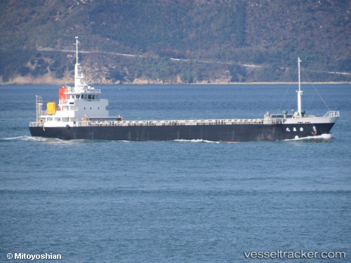
Reitaku
Current StatusWhere is the vessel?
Reitaku is currently in Near Imabari, based on AIS data received less than 1h ago.
Latest AIS update:
Current position: 34.08734° N, 133.04271° E (Near Imabari)
Average speed (last 7 days): Loading…
Average speed (last 30 days): Loading…
Vessel profile: Reitaku is a General Cargo Ship with dimensions 12m x 73m.
This page combines live AIS, route history, probable destination signals, nearby traffic, and port activity for practical vessel monitoring.
The current position of vessel Reitaku is 34.08734 lat / 133.04271 lng. Updated: 2026-05-17 13:55:14 UTCNearest reference points:
- Near Yoshiumi
- Near HAKATASHIMA
- Near NYUGAWA
Details:
Live Vessel Reitaku Analytics (details, animations, etc.)
Recent AIS points (UTC):
2026-05-17 10:27:40 UTC · 34.34039, 133.68367 · SOG 12.3 kn · COG 246°2026-05-17 11:34:53 UTC · 34.26254, 133.44667 · SOG 10.3 kn · COG 254°
2026-05-17 13:50:18 UTC · 34.09441, 133.05620 · SOG 9.9 kn · COG 237°
2026-05-17 13:55:14 UTC · 34.08734, 133.04271 · SOG 9.3 kn · COG 252°