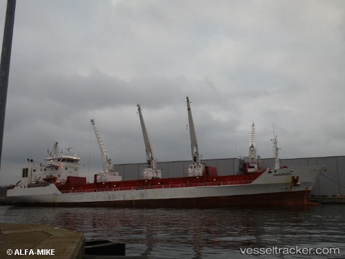
 HARENGUS
Current Status
Where is the vessel?
HARENGUS is currently in Near SOYO, based on AIS data received about 15h ago.
Latest AIS update:
Current position: 6.08289° S, 12.25773° E (Near SOYO)
Average speed (last 7 days): Loading…
Average speed (last 30 days): Loading…
Vessel profile: HARENGUS is a Reefer with dimensions m x m.
This page combines live AIS, route history, probable destination signals, nearby traffic, and port activity for practical vessel monitoring.
The current position of vessel HARENGUS is -6.08289 lat / 12.25773 lng. Updated: 2026-05-19 08:03:49 UTCNearest reference points:
- Near SOYO
- 11 nm W of Cabinda
- Near Futila Terminal
Currently sailing under the flag of Panama ![]()
Details:
Live Vessel HARENGUS Analytics (details, animations, etc.)
Recent AIS points (UTC):
2026-05-19 04:09:47 UTC · -6.08439, 12.25636 · SOG 0 kn · COG 110°2026-05-19 06:04:04 UTC · -6.08407, 12.25626 · SOG 0.1 kn · COG 120°
2026-05-19 07:55:50 UTC · -6.08286, 12.25757 · SOG 0 kn · COG 167°
2026-05-19 08:03:49 UTC · -6.08289, 12.25773 · SOG 0.1 kn · COG 179°