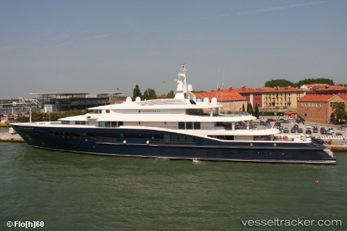
 CARINTHIA VII
Current Status
Where is the vessel?
CARINTHIA VII is currently in Near Sant Josep de sa Talaia, based on AIS data received about 15h ago.
Latest AIS update:
Current position: 38.85859° N, 1.30885° E (Near Sant Josep de sa Talaia)
Average speed (last 7 days): Loading…
Average speed (last 30 days): Loading…
Vessel profile: CARINTHIA VII is a Yacht with dimensions m x m.
This page combines live AIS, route history, probable destination signals, nearby traffic, and port activity for practical vessel monitoring.
The current position of vessel CARINTHIA VII is 38.85859 lat / 1.30885 lng. Updated: 2026-05-19 12:01:56 UTCNearest reference points:
- Near SANT ANTONI
- Near Sant Antoni de Portmany
- Near IBIZA
Currently sailing under the flag of Marshall Islands ![]()
Details:
Live Vessel CARINTHIA VII Analytics (details, animations, etc.)
Recent AIS points (UTC):
2026-05-19 08:04:53 UTC · 38.85827, 1.30920 · SOG 0 kn · COG 253°2026-05-19 10:04:53 UTC · 38.85838, 1.30906 · SOG 0.3 kn · COG 235°
2026-05-19 10:22:57 UTC · 38.85846, 1.30905 · SOG 0 kn · COG 235°
2026-05-19 12:01:56 UTC · 38.85859, 1.30885 · SOG 0 kn · COG 223°