 Pelagia
Current Status
Where is the vessel?
Pelagia is currently in Near Ben Schoeman Dock, based on AIS data received about 14h ago.
Latest AIS update:
Current position: 33.91683° S, 18.43917° E (Near Ben Schoeman Dock)
Average speed (last 7 days): Loading…
Average speed (last 30 days): Loading…
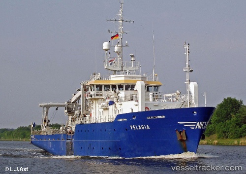
Vessel profile: Pelagia is a Research Vessel with dimensions 66m x 13m.
This page combines live AIS, route history, probable destination signals, nearby traffic, and port activity for practical vessel monitoring.
The current position of vessel Pelagia is -33.91683 lat / 18.43917 lng. Updated: 2026-05-21 01:45:15 UTCNearest reference points:
- Near Ben Schoeman Dock
- Near Salt River
- Near Cape Town
Currently sailing under the flag of Netherlands ![]()
Pelagia built in 1991 year
Deadweight:
525 tDetails:
Live Vessel Pelagia Analytics (details, animations, etc.)
Recent AIS points (UTC):
2026-05-20 23:03:13 UTC · -33.91683, 18.43917 · SOG 0 kn · COG 311°2026-05-20 23:25:09 UTC · -33.91667, 18.43833 · SOG 0 kn · COG -1°
2026-05-21 01:25:04 UTC · -33.91667, 18.43833 · SOG 0 kn · COG -1°
2026-05-21 01:45:15 UTC · -33.91683, 18.43917 · SOG 0 kn · COG 311°