 vesseltracker.com
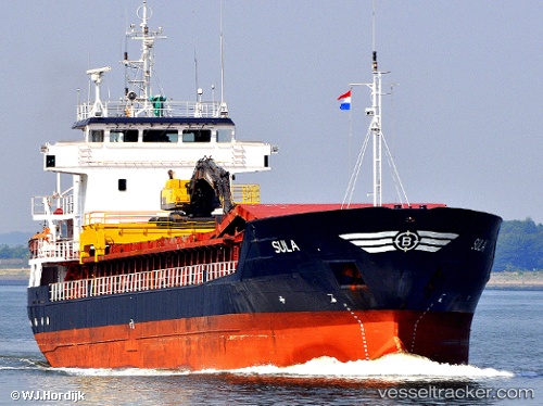
 Sula
Sula
Current Status
Where is the vessel?
Sula is currently in Near Fredrikstad, based on AIS data received less than 1h ago.
Latest AIS update:
Current position: 59.19114° N, 10.95027° E (Near Fredrikstad)
Average speed (last 7 days): Loading…
Average speed (last 30 days): Loading…
Vessel profile: Sula is a Multi Purpose Carrier with dimensions 87m x 13m.
This page combines live AIS, route history, probable destination signals, nearby traffic, and port activity for practical vessel monitoring.
The current position of vessel Sula is 59.19114 lat / 10.95027 lng. Updated: 2026-05-18 04:48:02 UTCNearest reference points:
- Near Utgårdskilen
- Near STROMSTAD
- Near Son
Currently sailing under the flag of Norway ![]()
Sula built in 1992 year
Deadweight:
3713 tDetails:
Live Vessel Sula Analytics (details, animations, etc.)
Recent AIS points (UTC):
2026-05-18 01:48:00 UTC · 59.19117, 10.95028 · SOG 0 kn · COG 350°2026-05-18 02:12:01 UTC · 59.19114, 10.95028 · SOG 0 kn · COG 350°
2026-05-18 03:42:12 UTC · 59.19118, 10.95030 · SOG 0 kn · COG 350°
2026-05-18 04:48:02 UTC · 59.19114, 10.95027 · SOG 0 kn · COG 351°