 vesseltracker.com
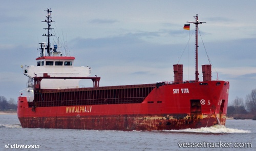
 SKY VISA
Current Status
Where is the vessel?
SKY VISA is currently in 11 nm S of Mathraki Diapontioi Island, based on AIS data received about 1h ago.
Latest AIS update:
Current position: 39.60309° N, 19.49441° E (11 nm S of Mathraki Diapontioi Island)
Average speed (last 7 days): Loading…
Average speed (last 30 days): Loading…
Vessel profile: SKY VISA is a General Cargo Ship with dimensions 13m x 88m.
This page combines live AIS, route history, probable destination signals, nearby traffic, and port activity for practical vessel monitoring.
The current position of vessel SKY VISA is 39.60309 lat / 19.49441 lng. Updated: 2026-05-17 17:50:25 UTCNearest reference points:
- Near Palaiokastritsa
- Near Agios Athanasios
- Near GOUVIA KONTOKALI
Currently sailing under the flag of Panama ![]()
SKY VISA built in 1991 year
Deadweight:
4195 tDetails:
Live Vessel SKY VISA Analytics (details, animations, etc.)
Recent AIS points (UTC):
2026-05-17 13:15:33 UTC · 40.06074, 19.10069 · SOG 6.6 kn · COG 132°2026-05-17 15:51:53 UTC · 39.81605, 19.33541 · SOG 7.5 kn · COG 135°
2026-05-17 16:18:34 UTC · 39.77120, 19.37479 · SOG 7.2 kn · COG 135°
2026-05-17 17:50:25 UTC · 39.60309, 19.49441 · SOG 7.5 kn · COG 150°