 vesseltracker.com
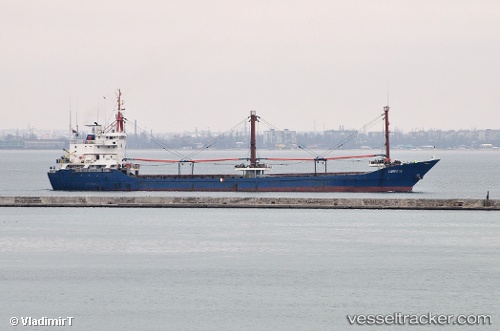
 UMIT G
Current Status
Where is the vessel?
UMIT G is currently in 10 nm W of Plomárion, based on AIS data received about 1h ago.
Latest AIS update:
Current position: 38.94879° N, 26.15521° E (10 nm W of Plomárion)
Average speed (last 7 days): Loading…
Average speed (last 30 days): Loading…
Vessel profile: UMIT G is a General Cargo Ship with dimensions 95m x 14m.
This page combines live AIS, route history, probable destination signals, nearby traffic, and port activity for practical vessel monitoring.
The current position of vessel UMIT G is 38.94879 lat / 26.15521 lng. Updated: 2026-05-18 02:11:31 UTCNearest reference points:
- Near MITHYMNA
- Near CESME
- Near Baba Point
Currently sailing under the flag of Panama ![]()
UMIT G built in 1991 year
Deadweight:
4495 tDetails:
Live Vessel UMIT G Analytics (details, animations, etc.)
Recent AIS points (UTC):
2026-05-17 23:06:01 UTC · 38.82357, 26.66965 · SOG 7.9 kn · COG 291°2026-05-17 23:40:42 UTC · 38.85166, 26.57564 · SOG 8.2 kn · COG 283°
2026-05-18 02:11:31 UTC · 38.94879, 26.15521 · SOG 8.3 kn · COG 286°
2026-05-18 02:11:31 UTC · 38.94879, 26.15521 · SOG 8.3 kn · COG 286°