 vesseltracker.com
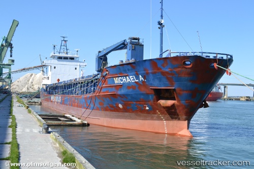
Michael A.
Current StatusWhere is the vessel?
Michael A. is currently in 136 nm E of Raichur, based on AIS data received about 14h ago.
Latest AIS update:
Current position: 15.60552° N, 75.09646° W (136 nm E of Raichur)
Average speed (last 7 days): Loading…
Average speed (last 30 days): Loading…
Vessel profile: Michael A. is a Multi Purpose Carrier with dimensions 13m x 88m.
This page combines live AIS, route history, probable destination signals, nearby traffic, and port activity for practical vessel monitoring.
The current position of vessel Michael A. is 15.60552 lat / -75.09646 lng. Updated: 2026-05-18 09:54:15 UTCDetails:
Live Vessel Michael A. Analytics (details, animations, etc.)
Recent AIS points (UTC):
2026-05-18 05:56:31 UTC · 16.10843, -75.07301 · SOG 8.1 kn · COG 174°2026-05-18 05:56:31 UTC · 16.10843, -75.07301 · SOG 8.1 kn · COG 174°
2026-05-18 08:15:24 UTC · 15.81238, -75.08872 · SOG 7.5 kn · COG 174°
2026-05-18 09:54:15 UTC · 15.60552, -75.09646 · SOG 7.5 kn · COG 176°