 vesseltracker.com
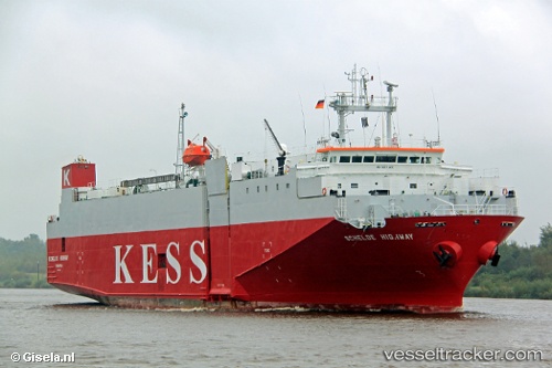
 Schelde Highway
Current Status
Where is the vessel?
Schelde Highway is currently in 14 nm W of Grampound, based on AIS data received less than 1h ago.
Latest AIS update:
Current position: 50.42709° N, 5.85271° W (14 nm W of Grampound)
Average speed (last 7 days): Loading…
Average speed (last 30 days): Loading…
Vessel profile: Schelde Highway is a Vehicles Carrier with dimensions 100m x 21m.
This page combines live AIS, route history, probable destination signals, nearby traffic, and port activity for practical vessel monitoring.
The current position of vessel Schelde Highway is 50.42709 lat / -5.85271 lng. Updated: 2026-05-17 11:55:47 UTCNearest reference points:
- 10 nm NW of Grampound
- Near Isles of Scilly
- Near Flushing
Currently sailing under the flag of Panama ![]()
Schelde Highway built in 1993 year
Deadweight:
3222 tDetails:
Live Vessel Schelde Highway Analytics (details, animations, etc.)
Recent AIS points (UTC):
2026-05-17 08:06:35 UTC · 49.91295, -5.18361 · SOG 14.5 kn · COG 264°2026-05-17 10:21:17 UTC · 50.07586, -5.86497 · SOG 13.2 kn · COG 0°
2026-05-17 10:32:06 UTC · 50.11564, -5.86510 · SOG 13.2 kn · COG 1°
2026-05-17 11:55:47 UTC · 50.42709, -5.85271 · SOG 13.6 kn · COG 7°