 vesseltracker.com
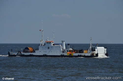
 Mira A
Current Status
Where is the vessel?
Mira A is currently in Near NYBORG, based on AIS data received about 14h ago.
Latest AIS update:
Current position: 55.30073° N, 10.80427° E (Near NYBORG)
Average speed (last 7 days): Loading…
Average speed (last 30 days): Loading…
Vessel profile: Mira A is a Deck Cargo Ship with dimensions 54m x 12m.
This page combines live AIS, route history, probable destination signals, nearby traffic, and port activity for practical vessel monitoring.
The current position of vessel Mira A is 55.30073 lat / 10.80427 lng. Updated: 2026-05-18 14:15:20 UTCNearest reference points:
- Near Lindholm Havn
- Near Lundeborg
- Near Svendborg
Currently sailing under the flag of Denmark ![]()
Mira A built in 1969 year
Deadweight:
200 tDetails:
Live Vessel Mira A Analytics (details, animations, etc.)
Recent AIS points (UTC):
2026-05-18 10:39:21 UTC · 55.30074, 10.80428 · SOG 0 kn · COG 204°2026-05-18 11:51:33 UTC · 55.30075, 10.80427 · SOG 0 kn · COG -1°
2026-05-18 13:36:43 UTC · 55.30073, 10.80427 · SOG 0 kn · COG -1°
2026-05-18 14:15:20 UTC · 55.30073, 10.80427 · SOG 0 kn · COG 204°