 vesseltracker.com
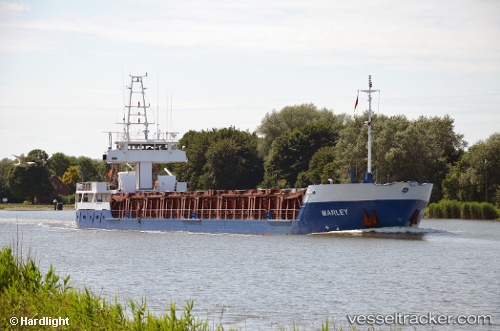
Marley
Current StatusWhere is the vessel?
Marley is currently in 26 nm NW of TENES, based on AIS data received about 14h ago.
Latest AIS update:
Current position: 36.84707° N, 0.95774° E (26 nm NW of TENES)
Average speed (last 7 days): Loading…
Average speed (last 30 days): Loading…
Vessel profile: Marley is a Multi Purpose Carrier with dimensions 11m x 91m.
This page combines live AIS, route history, probable destination signals, nearby traffic, and port activity for practical vessel monitoring.
The current position of vessel Marley is 36.84707 lat / 0.95774 lng. Updated: 2026-05-18 04:14:08 UTCNearest reference points:
- 50 nm N of Mostaganem
- 43 nm NW of Mostaganem
- Near Mostaganem
Details:
Live Vessel Marley Analytics (details, animations, etc.)
Recent AIS points (UTC):
2026-05-18 01:42:43 UTC · 36.76333, 0.49167 · SOG 8 kn · COG -1°2026-05-18 02:15:06 UTC · 36.78471, 0.58877 · SOG 8.9 kn · COG 75°
2026-05-18 03:39:57 UTC · 36.82829, 0.84958 · SOG 9.2 kn · COG 74°
2026-05-18 04:14:08 UTC · 36.84707, 0.95774 · SOG 9.4 kn · COG 75°