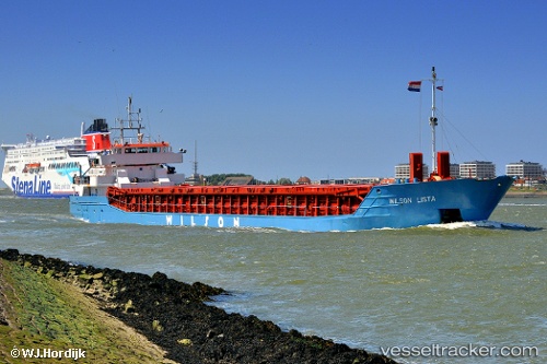
 WILSON LISTA
Current Status
Where is the vessel?
WILSON LISTA is currently in 15 nm W of Thorntonbank, based on AIS data received about 14h ago.
Latest AIS update:
Current position: 51.67686° N, 2.52095° E (15 nm W of Thorntonbank)
Average speed (last 7 days): Loading…
Average speed (last 30 days): Loading…
Vessel profile: WILSON LISTA is a General Cargo with dimensions m x m.
This page combines live AIS, route history, probable destination signals, nearby traffic, and port activity for practical vessel monitoring.
The current position of vessel WILSON LISTA is 51.67686 lat / 2.52095 lng. Updated: 2026-05-20 08:06:22 UTCNearest reference points:
- 13 nm NW of Middelkerke
- 21 nm S of Craven Arms
- Near Thorntonbank
Currently sailing under the flag of Norway ![]()
Details:
Live Vessel WILSON LISTA Analytics (details, animations, etc.)
Recent AIS points (UTC):
2026-05-20 04:43:12 UTC · 51.13368, 1.84243 · SOG 13.4 kn · COG 57°2026-05-20 06:05:56 UTC · 51.34737, 2.15538 · SOG 12.5 kn · COG 28°
2026-05-20 07:44:04 UTC · 51.62028, 2.44988 · SOG 11.7 kn · COG 40°
2026-05-20 08:06:22 UTC · 51.67686, 2.52095 · SOG 11.2 kn · COG 45°