Tan Cang Foundation
Current StatusWhere is the vessel?
Tan Cang Foundation is currently in 65 nm E of Hon La Port, based on AIS data received about 14h ago.
Latest AIS update:
Current position: 17.97667° N, 107.65333° E (65 nm E of Hon La Port)
Average speed (last 7 days): Loading…
Average speed (last 30 days): Loading…
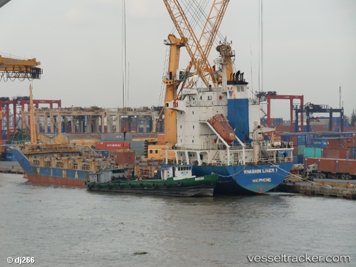
Vessel profile: Tan Cang Foundation is a Container Ship with dimensions 18m x 113m.
This page combines live AIS, route history, probable destination signals, nearby traffic, and port activity for practical vessel monitoring.
The current position of vessel Tan Cang Foundation is 17.97667 lat / 107.65333 lng. Updated: 2026-05-20 14:20:58 UTCNearest reference points:
- 61 nm E of Hon La Port
- 60 nm SW of Ledong
- 48 nm NE of Cua Viet Port
Details:
Live Vessel Tan Cang Foundation Analytics (details, animations, etc.)
Recent AIS points (UTC):
2026-05-20 10:28:13 UTC · 17.39284, 107.91904 · SOG 10 kn · COG 337°2026-05-20 11:53:59 UTC · 17.62333, 107.81667 · SOG 10 kn · COG -1°
2026-05-20 12:44:58 UTC · 17.74833, 107.75833 · SOG 9 kn · COG -1°
2026-05-20 14:20:58 UTC · 17.97667, 107.65333 · SOG 9 kn · COG -1°