 ODDA MARIE
Current Status
Where is the vessel?
ODDA MARIE is currently in Near Marfleet, based on AIS data received about 15h ago.
Latest AIS update:
Current position: 53.74469° N, 0.26931° W (Near Marfleet)
Average speed (last 7 days): Loading…
Average speed (last 30 days): Loading…
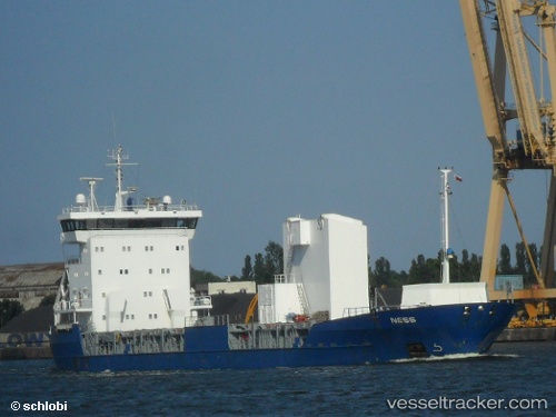
Vessel profile: ODDA MARIE is a General Cargo Ship with dimensions 100m x 15m.
This page combines live AIS, route history, probable destination signals, nearby traffic, and port activity for practical vessel monitoring.
The current position of vessel ODDA MARIE is 53.74469 lat / -0.26931 lng. Updated: 2026-05-19 12:22:18 UTCNearest reference points:
- Near Hull
- Near Immingham
- Near Hessle/Hull
Currently sailing under the flag of Finland ![]()
ODDA MARIE built in 1996 year
Deadweight:
5000 tDetails:
Live Vessel ODDA MARIE Analytics (details, animations, etc.)
Recent AIS points (UTC):
2026-05-19 07:51:24 UTC · 53.74394, -0.26829 · SOG 1.6 kn · COG 119°2026-05-19 10:14:58 UTC · 53.74469, -0.26930 · SOG 0 kn · COG 107°
2026-05-19 10:58:43 UTC · 53.74468, -0.26933 · SOG 0 kn · COG 108°
2026-05-19 12:22:18 UTC · 53.74469, -0.26931 · SOG 0 kn · COG 108°