Ship 115
Current StatusWhere is the vessel?
Ship 115 is currently in Near Jabung Terminal, based on AIS data received about 14h ago.
Latest AIS update:
Current position: 0.91808° S, 104.08267° E (Near Jabung Terminal)
Average speed (last 7 days): Loading…
Average speed (last 30 days): Loading…
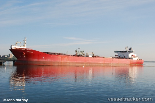
Vessel profile: Ship 115 is a Crude Oil Tanker with dimensions 46m x 272m.
This page combines live AIS, route history, probable destination signals, nearby traffic, and port activity for practical vessel monitoring.
The current position of vessel Ship 115 is -0.91808 lat / 104.08267 lng. Updated: 2026-05-19 16:57:33 UTCNearest reference points:
- Near Jabung Terminal
- 16 nm E of Kualamandah
- 16 nm E of Tanjung Uban
Details:
Live Vessel Ship 115 Analytics (details, animations, etc.)
Recent AIS points (UTC):
2026-05-19 13:12:34 UTC · -0.91806, 104.08265 · SOG 0 kn · COG -1°2026-05-19 14:03:35 UTC · -0.91807, 104.08270 · SOG 0 kn · COG -1°
2026-05-19 15:24:35 UTC · -0.91809, 104.08266 · SOG 0 kn · COG -1°
2026-05-19 16:57:33 UTC · -0.91808, 104.08267 · SOG 0 kn · COG -1°