 Viking Alliance
Current Status
Where is the vessel?
Viking Alliance is currently in Near PORT ALBERNI, based on AIS data received about 1d ago.
Latest AIS update:
Current position: 49.22500° N, 124.81333° W (Near PORT ALBERNI)
Average speed (last 7 days): Loading…
Average speed (last 30 days): Loading…
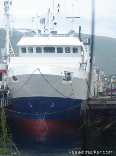
Vessel profile: Viking Alliance is a Fishing Vessel with dimensions 41m x 41m.
This page combines live AIS, route history, probable destination signals, nearby traffic, and port activity for practical vessel monitoring.
The current position of vessel Viking Alliance is 49.22500 lat / -124.81333 lng. Updated: 2026-05-21 00:45:59 UTCNearest reference points:
- 21 nm NW of Tatoosh Island
- Near Powell River
- Near Nanaimo
Currently sailing under the flag of Canada ![]()
Viking Alliance built in 1996 year
Deadweight:
401 tDetails:
Live Vessel Viking Alliance Analytics (details, animations, etc.)
Recent AIS points (UTC):
2026-05-21 00:45:59 UTC · 49.22500, -124.81333 · SOG 0 kn · COG -1°2026-05-21 00:45:59 UTC · 49.22500, -124.81333 · SOG 0 kn · COG -1°
2026-05-21 00:45:59 UTC · 49.22500, -124.81333 · SOG 0 kn · COG -1°
2026-05-21 00:45:59 UTC · 49.22500, -124.81333 · SOG 0 kn · COG -1°