 Samskip Commander
Current Status
Where is the vessel?
Samskip Commander is currently in Near Damsgård, based on AIS data received about 14h ago.
Latest AIS update:
Current position: 60.38500° N, 5.31333° E (Near Damsgård)
Average speed (last 7 days): Loading…
Average speed (last 30 days): Loading…
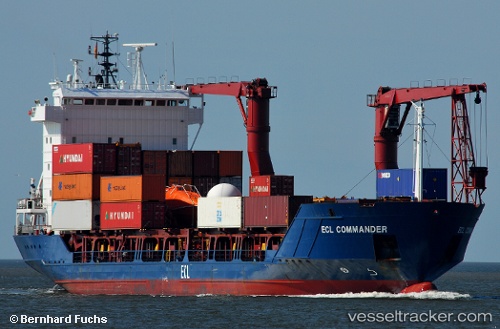
Vessel profile: Samskip Commander is a Container Ship with dimensions 101m x 16m.
This page combines live AIS, route history, probable destination signals, nearby traffic, and port activity for practical vessel monitoring.
The current position of vessel Samskip Commander is 60.38500 lat / 5.31333 lng. Updated: 2026-05-18 17:31:23 UTCNearest reference points:
- Near Bergen
- Near Damsgård
- Near Skålevik
Currently sailing under the flag of Barbados ![]()
Samskip Commander built in 1997 year
Deadweight:
4765 tDetails:
Live Vessel Samskip Commander Analytics (details, animations, etc.)
Recent AIS points (UTC):
2026-05-18 14:15:54 UTC · 60.38536, 5.31396 · SOG 0 kn · COG 134°2026-05-18 15:51:57 UTC · 60.38536, 5.31396 · SOG 0.1 kn · COG 133°
2026-05-18 16:33:53 UTC · 60.38536, 5.31396 · SOG 0 kn · COG 133°
2026-05-18 17:31:23 UTC · 60.38500, 5.31333 · SOG 0 kn · COG -1°