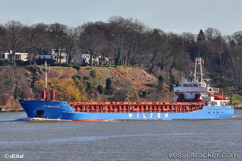
 WILSON BRUGGE
Current Status
Where is the vessel?
WILSON BRUGGE is currently in Near Billinge, based on AIS data received about 15h ago.
Latest AIS update:
Current position: 53.84238° N, 3.44644° W (Near Billinge)
Average speed (last 7 days): Loading…
Average speed (last 30 days): Loading…
Vessel profile: WILSON BRUGGE is a General Cargo with dimensions m x m.
This page combines live AIS, route history, probable destination signals, nearby traffic, and port activity for practical vessel monitoring.
The current position of vessel WILSON BRUGGE is 53.84238 lat / -3.44644 lng. Updated: 2026-05-18 20:01:26 UTCNearest reference points:
- Near LIVERPOOL ANCH
- Near BIRKENHEAD
- Near Rhôs-on-Sea
Currently sailing under the flag of Bahamas ![]()
Details:
Live Vessel WILSON BRUGGE Analytics (details, animations, etc.)
Recent AIS points (UTC):
2026-05-18 16:24:06 UTC · 53.81929, -4.05054 · SOG 5.9 kn · COG 98°2026-05-18 18:00:04 UTC · 53.79057, -3.77035 · SOG 6.2 kn · COG 93°
2026-05-18 19:38:56 UTC · 53.81720, -3.49657 · SOG 6.2 kn · COG 43°
2026-05-18 20:01:26 UTC · 53.84238, -3.44644 · SOG 6.1 kn · COG 40°