 Katrin Johanna
Current Status
Where is the vessel?
Katrin Johanna is currently in 13 nm SW of SANDUR, based on AIS data received about 14h ago.
Latest AIS update:
Current position: 61.74183° N, 7.23373° W (13 nm SW of SANDUR)
Average speed (last 7 days): Loading…
Average speed (last 30 days): Loading…
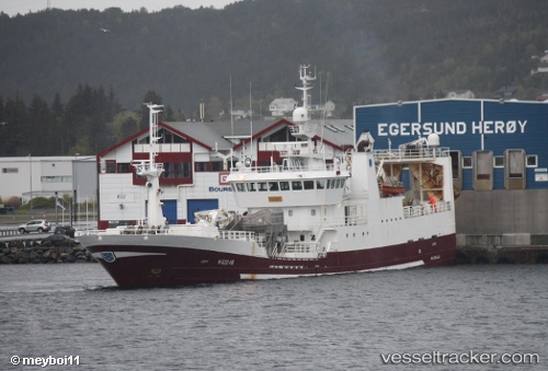
Vessel profile: Katrin Johanna is a Fish Carrier with dimensions 73m x 13m.
This page combines live AIS, route history, probable destination signals, nearby traffic, and port activity for practical vessel monitoring.
The current position of vessel Katrin Johanna is 61.74183 lat / -7.23373 lng. Updated: 2026-05-19 12:25:32 UTCNearest reference points:
- Near VESTMANNA
- 20 nm S of Vágur
- Near FUGLAFJORDUR
Currently sailing under the flag of Faroe Is ![]()
Katrin Johanna built in 1997 year
Deadweight:
2218 tDetails:
Live Vessel Katrin Johanna Analytics (details, animations, etc.)
Recent AIS points (UTC):
2026-05-19 07:54:04 UTC · 61.27181, -7.48864 · SOG 1.6 kn · COG 284°2026-05-19 10:14:08 UTC · 61.38208, -7.51751 · SOG 10.2 kn · COG 17°
2026-05-19 11:00:22 UTC · 61.50816, -7.43394 · SOG 10.6 kn · COG 18°
2026-05-19 12:25:32 UTC · 61.74183, -7.23373 · SOG 10.3 kn · COG 29°