 vesseltracker.com
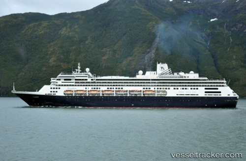
 Zaandam
Current Status
Where is the vessel?
Zaandam is currently in Near Tyee, based on AIS data received about 14h ago.
Latest AIS update:
Current position: 57.11404° N, 134.71109° W (Near Tyee)
Average speed (last 7 days): Loading…
Average speed (last 30 days): Loading…
Vessel profile: Zaandam is a Cruise Ship with dimensions 238m x 32m.
This page combines live AIS, route history, probable destination signals, nearby traffic, and port activity for practical vessel monitoring.
The current position of vessel Zaandam is 57.11404 lat / -134.71109 lng. Updated: 2026-05-18 05:28:46 UTCNearest reference points:
- Near Sitka
- Near Juneau
- Near Wrangell
Currently sailing under the flag of Netherlands ![]()
Zaandam built in 2000 year
Deadweight:
6150 tDetails:
Live Vessel Zaandam Analytics (details, animations, etc.)
Recent AIS points (UTC):
2026-05-18 01:24:06 UTC · 58.19698, -135.39326 · SOG 15.4 kn · COG 115°2026-05-18 03:24:30 UTC · 57.74203, -134.81996 · SOG 18.2 kn · COG 172°
2026-05-18 04:04:12 UTC · 57.53975, -134.76608 · SOG 18.6 kn · COG 173°
2026-05-18 05:28:46 UTC · 57.11404, -134.71109 · SOG 18.1 kn · COG 169°