 vesseltracker.com
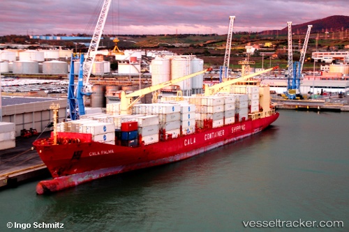
 Cala Palma
Current Status
Where is the vessel?
Cala Palma is currently in 20 nm N of Cariari, based on AIS data received about 14h ago.
Latest AIS update:
Current position: 10.52031° N, 82.12595° W (20 nm N of Cariari)
Average speed (last 7 days): Loading…
Average speed (last 30 days): Loading…
Vessel profile: Cala Palma is a Refrigerated Cargo Ship with dimensions 190m x 190m.
This page combines live AIS, route history, probable destination signals, nearby traffic, and port activity for practical vessel monitoring.
The current position of vessel Cala Palma is 10.52031 lat / -82.12595 lng. Updated: 2026-05-18 08:14:40 UTCNearest reference points:
- Near Chiriquí Grande
- Near Colon
- Near Colón Free Zone
Currently sailing under the flag of Italy ![]()
Cala Palma built in 2000 year
Deadweight:
16024 tDetails:
Live Vessel Cala Palma Analytics (details, animations, etc.)
Recent AIS points (UTC):
2026-05-18 04:42:59 UTC · 10.07151, -83.00579 · SOG 14.9 kn · COG 61°2026-05-18 06:03:54 UTC · 10.23216, -82.65916 · SOG 16.6 kn · COG 59°
2026-05-18 07:00:52 UTC · 10.35429, -82.42199 · SOG 16.5 kn · COG 60°
2026-05-18 08:14:40 UTC · 10.52031, -82.12595 · SOG 16.1 kn · COG 61°