 vesseltracker.com
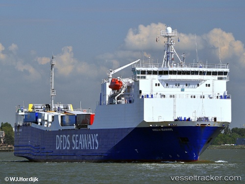
 Blue Carrier 1
Current Status
Where is the vessel?
Blue Carrier 1 is currently in Near Drapetzona, based on AIS data received about 14h ago.
Latest AIS update:
Current position: 37.95323° N, 23.60655° E (Near Drapetzona)
Average speed (last 7 days): Loading…
Average speed (last 30 days): Loading…
Vessel profile: Blue Carrier 1 is a Ro Ro Cargo Ship with dimensions 143m x 23m.
This page combines live AIS, route history, probable destination signals, nearby traffic, and port activity for practical vessel monitoring.
The current position of vessel Blue Carrier 1 is 37.95323 lat / 23.60655 lng. Updated: 2026-05-18 09:46:23 UTCNearest reference points:
- Near Drapetzona
- Near Keratsínion
- Near Piraeus
Currently sailing under the flag of Greece ![]()
Blue Carrier 1 built in 2000 year
Deadweight:
4650 tDetails:
Live Vessel Blue Carrier 1 Analytics (details, animations, etc.)
Recent AIS points (UTC):
2026-05-18 05:55:42 UTC · 37.83087, 23.66448 · SOG 15.9 kn · COG 331°2026-05-18 07:16:32 UTC · 37.92753, 23.59563 · SOG 0.1 kn · COG 290°
2026-05-18 07:52:12 UTC · 37.92264, 23.59252 · SOG 0.4 kn · COG 260°
2026-05-18 09:46:23 UTC · 37.95323, 23.60655 · SOG 0.1 kn · COG 290°